

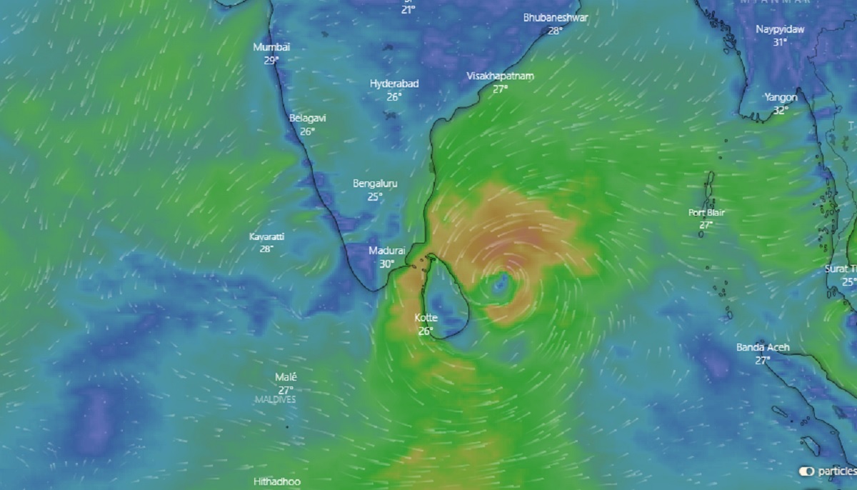

The Meteorological Department said that the sea level could rise by about one meter above the tidal wave level as cyclone ‘Burevi’ approaches the east coast of Sri Lanka. The Department of Meteorology said that due to this the wind speed in the sea areas around the island could instantly increase up to 80 to 100 km per hour.
A statement issued by the Meteorological Department said that cyclone ‘Burevi’ in the Bay of Bengal is likely to enter the island from the East Coast this evening or at night. The department said that the cyclone could enter the island from between Batticaloa and Point Pedro areas.
It is currently located 330 km southeast of Trincomalee.The cyclone will gradually move westwards and blow into the Gulf of Mannar.
Extreme winds of 80 to 100 kmph are expected in the North, North Central, Eastern, North Western, Western, Central and Sabaragamuwa Provinces. The Met Department said that most parts of the North, North Central, Eastern and Northwestern Provinces will receive showers and heavy showers of more than 200 mm in some places.
Heavy showers of more than 100 mm are expected in other parts of the island as well.Meanwhile, steps have been taken to evacuate people from dangerous areas in the Trincomalee District to safer places this afternoon. District Secretary Saman Dharshana Padikorala stated that the people of the district have already been informed about the current cyclone situation.


